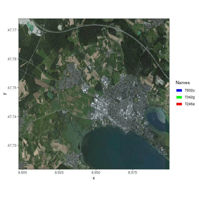
Using a mapbox satellite base map
example-3.RmdNote: This vignette has not yet been updated to the most recent
moveVis version. Displayed code will likely not work as it
relies on deprecated dependencies such as move (replaced by
move2) or raster (replaced by
terra). For details, see the help pages of
moveVis and the README as those resources have already been
updated.
Thanks to the
slippymath
package used by frames_spatial, you can use
mapbox base maps (e.g. satellite):
library(moveVis)
library(move)

data("move_data")

# align movement to unique times and regular resolution
m <- align_move(move_data, res = 4, unit = "mins")

## assign some path colours by individual
m.list <- split(m) # split m into list by individual
m.list <- mapply(x = m.list, y = c("red", "green", "blue"), function(x, y){
  x$colour <- y
  return(x)
}) # add colour per individual
m <- moveStack(m.list) # putting it back together into a moveStack

# create frames with mapbox satellite basemap
frames <- frames_spatial(m, map_service = "mapbox", map_type = "satellite",
                         map_token = "YOUR_MAPBOX_TOKEN")
# register at http://www.mapbox.com to get a free mapbox token
# that allows you to do 50.000 map requests per month free of charge

# animate the first 100 frames as example
animate_frames(frames[1:100], out_file = "example_3a.gif")
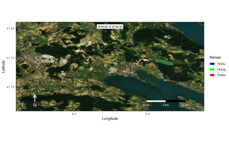
In case, you do not want to force the calculation of an equidistant
(squared) extent with x and y axis representing equal surface distances,
you can turn it off by setting equidistant = FALSE.
# to not calculate a squared (enlarged) extent:
frames <- frames_spatial(m, map_service = "mapbox", map_type = "satellite",
                         map_token = "YOUR_MAPBOX_TOKEN", equidistant = FALSE)
You can also use a custom extent (and use the pipe to customize frames):
ext <- extent(8.820289, 9.076893, 47.68715, 47.80863)

# set the ext argument
frames <- frames_spatial(m, map_service = "mapbox", map_type = "satellite",
                         map_token = "YOUR_MAPBOX_TOKEN", ext = ext, equidistant = FALSE) %>%
  add_labels(x = "Longitude", y = "Latitude") %>%
  add_northarrow(colour = "white", height = 0.08, position = "bottomleft") %>%
  add_scalebar(colour = "white", height = 0.022, position = "bottomright", label_margin = 1.4) %>%
  add_timestamps(m, type = "label")

# animate the first 100 frames as example
animate_frames(frames[1:100], out_file = "example_3b.gif",
               height = 500, width = 800, res = 82)
For further details, see
?frames_spatial.